
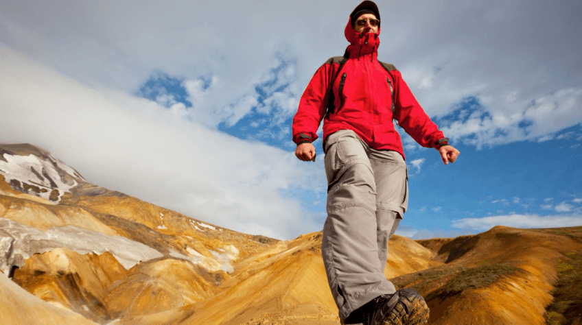
Iceland is a hiker’s playground, no matter the skill level. But finding the best ones – and more importantly, getting to them – requires some inside knowledge. Most of Iceland’s best day hikes are reachable in a standard 2WD camper van. The big exception is the Highlands: Kerlingarfjöll, Askja, Landmannalaugar and the Laugavegur trailhead sit on F-roads, where you need a suitable 4×4 and must check road conditions before you travel. Hornstrandir is different again: you reach it by boat, not camper van.
For most hiking trips, plan around two groups. Pick Ring Road and regional hikes if you want straightforward road access and campsites nearby. Choose Highland hikes only if your route, vehicle, season, and driving experience all fit F-road travel. The main trekking window is usually June to September, but conditions can still change quickly.
In This Guide
- Standard-Road Hikes
- Highland/F-Road Hikes
- Hikes That Need a Different Plan
- Vehicle Access Table
- What to Pack
- How to Prepare
- FAQs
Hikes You Can Reach From the Ring Road or Standard Roads
These hikes do not normally require F-road driving to reach the usual trailhead. Road, weather, and seasonal conditions can still affect a trip, so check current information before setting out.
Svartifoss
Standard-road access
The path from Skaftafell climbs gently through birch scrub for about 1.7 km (1.1 miles), and you’ll hear Svartifoss before you round the final bend, a low roar bouncing off rock. Then the columns come into view: hundreds of black basalt hexagons, packed together like the pipes of a vast organ, with the falls dropping straight through a gap in the middle. Iceland’s basalt architecture inspired the tiered facade of Hallgrímskirkja church in Reykjavík, and standing here, you can see exactly why. Give yourself time to walk the viewing platforms on either side; the columns look different depending on whether the water’s catching the light or you’re in shadow. Use Skaftafell as a practical base, and see our Iceland campsites guide for planning an overnight stop.
Dyrfjöll and Stórurð
Standard-road access
This one earns its reputation. The trail climbs into a boulder field where car-sized rocks have tumbled down from the Dyrfjöll ridge over centuries, and tucked between them are turquoise pools so clear they look tinted. It’s a 7–8 mile (11–13 km) loop, and the rocky sections slow you down, so budget a full day rather than rushing it. Go in summer when the snow’s cleared; the pools are the whole point, and they’re often still frozen over well into June.
Þakgil
Standard-road access
Þakgil sits tucked behind a ridge of green, moss-covered canyon walls that block the wind and make the whole valley feel sheltered, almost hidden, even though you’re not far from Vík. A handful of half-day trails branch out from the campsite, taking you up onto rock formations that open into wider highland views. It’s an easy add-on rather than a destination in itself, so pair it with a night camped near Vík to break up the drive and give yourself a proper look around.
Reykjadalur
Standard-road access
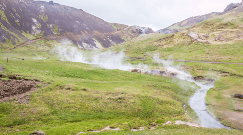
Follow the steam rising off the hillside, and it leads you straight to the valley, a two-mile walk with a steady climb that has you shedding layers on the way up and wanting them back the moment you sit in the river. That’s the reward: a stretch of the water runs warm enough to soak in, so bring a towel and something to change into. Conditions shift fast up here, so pack for both the climb and the sit-still afterwards.
Arnarstapi
Standard-road access
This is the walk to do on a lighter day. A clifftop path follows the coast toward Hellnar, past sea stacks and arches that the Atlantic has spent centuries carving into the black rock, and in summer the cliffs fill with nesting birds, arctic terns diving, fulmars gliding along the updrafts. It’s flat, short, and easy to fit into a bigger Snæfellsnes route without eating your whole day, but the scenery punches well above its length.
For more planning, see our guide to Snæfellsnes.
Glymur
Standard-road access
Glymur was Iceland’s tallest known waterfall until Morsárfoss overtook it in 2011, and the hike there earns its reputation for a reason. The route climbs steep, rocky ground, crosses a cave partway up, and rewards you with views straight down the gorge to the falls dropping through it. Conditions and river crossings change, so check current route information before you go.
Fagradalsfjall
Standard-road access
This is Iceland’s youngest landscape, and it’s still being shaped by volcanic activity. Eruptions here since 2021 have sent lava spreading across the valley floor, and depending on when you visit, you might be walking past rock that was still glowing months earlier. That same activity means the area can shift fast, so only hike approved routes when it’s officially open, and follow closures and safety guidance without cutting corners.
Látrabjarg
Standard-road access
These are some of Iceland’s highest sea cliffs, and in summer they’re packed with puffins, so close in places you could reach out and touch one (you shouldn’t, but you could – find out more in our guide to puffins in Iceland). The walking itself is mostly level and easy going, but the wind here has real force, and the drop-offs are sheer, so keep well back from the edge. It’s a long drive out to the Westfjords, too long for a rushed day trip, so build it properly into a longer itinerary rather than bolting it on.
Esja
Standard-road access
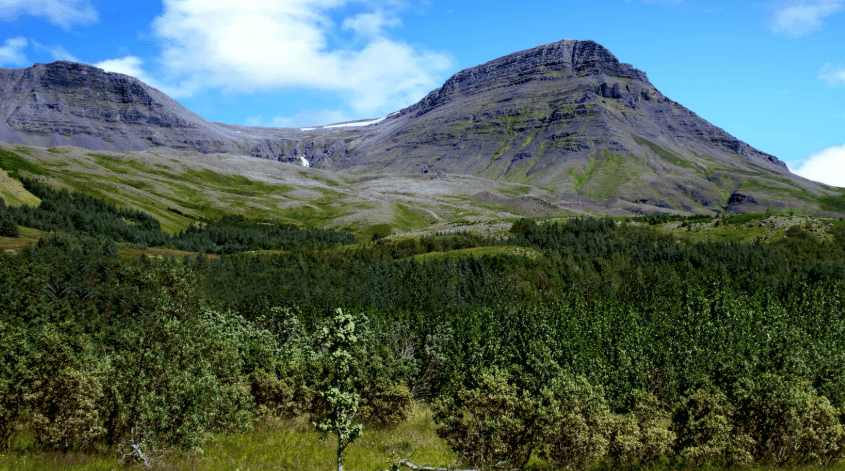
Esja is the mountain that watches over Reykjavík, visible from most of the city on a clear day, which makes it an easy pull if you’re based there for a few days. Lower paths are gentle and well-trodden, good for an easy afternoon, but push higher, and the terrain turns steep and rocky fast, especially near the Þverfellshorn summit. Pick your route to match your legs rather than your ambition; there’s no shame in turning back at the steeper sections.
Keilir
Standard-road access
Keilir’s shape gives it away from miles off, a near-perfect cone rising out of the flat lava fields around Reykjanes, which made it a handy landmark for sailors for centuries. The climb is steady rather than technical, but it’s unprotected the whole way, no ropes, no railings, just rock underfoot, so it suits hikers who are comfortable moving on exposed ground without a safety net. The reward at the top is a 360-degree view over the peninsula that makes the legwork worth it.
Vífilsfell
Standard-road access
Vífilsfell is the shorter cousin to Esja, a compact summit push rather than a day-long commitment, but don’t mistake short for easy. The ascent is steady, and the ground turns rocky as you climb, enough that some scrambling experience helps more than raw fitness does. It’s a good pick when you want a proper summit under your legs without giving up a whole day to it.
Móskarðshnúkar
Standard-road access
The draw here is color: rhyolite peaks streaked in ochre and rust, a strange contrast to the black lava fields you’ll have gotten used to elsewhere in Iceland. It’s a 3–4 mile route, easy enough at the start, then steeper near the top where the loose scree slows you down and makes the last stretch feel earned. Worth the effort for the view alone, especially with low sun catching the colors in the rock.
Víknaslóðir Trek
Standard-road access to regional start points
This is the Eastfjords trek that keeps hikers coming back for years running, a multi-day route through abandoned fishing villages and remote valleys along a stretch of coast most visitors never see. It’s a serious undertaking rather than a day out, so treat access, accommodation, and daily distances as their own planning task well before you set off. For prepared hikers, though, the reward is days of near-solitude in some of the most dramatic coastline in the country.
Highland Hikes That Require 4×4/F-Road Planning
F-roads are not ordinary gravel roads. They are seasonal mountain routes, and access depends on conditions. A standard 2WD camper van is not the right vehicle for them. Before you plan one of these hikes, read our guide to driving the Highlands in Iceland and choose a suitable 4×4 camper. Check umferdin.is on the day you travel.
Kerlingarfjöll
4×4/F-road planning
Hveradalir sits at the heart of this range, a geothermal valley streaked in reds and yellows, steam rising off the ground between patches of snow that can linger well into summer. Trails here range from short valley walks to longer, steeper routes up into the surrounding peaks, so there’s something for whatever pace you’re after. Getting there is its own commitment though: the F-roads in are rough, so build the drive into your plan rather than treating it as a formality before the hiking starts.
Askja Caldera
4×4/F-road planning
Askja sits deep in the Highlands, a volcanic caldera holding a lake that’s still faintly warm from geothermal activity below it, ringed by rock so raw and empty that NASA sent Apollo astronauts here to train before the moon landings. The approach roads are rugged, and the weather can turn fast even by Highland standards, so this isn’t a hike to squeeze in on a whim. Leave enough daylight for both the drive in and the walk itself; you don’t want to be racing either one.
Mt. Snæfell
4×4/F-road planning
Not to be confused with the Snæfellsjökull glacier of Jules Verne fame, this Snæfell is the tallest standalone mountain in Iceland, rising alone out of the Highlands with nothing around it to compete for scale. The route up is demanding, a serious amount of ascent over rocky, uneven ground, so this is one for hikers with some summit experience already behind them. Clear days reward you with views that stretch across a huge stretch of the eastern interior.
Landmannalaugar
4×4/F-road planning
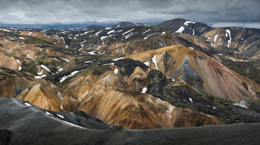
Landmannalaugar is where the Highlands show off: rhyolite hills striped in orange, pink, and green, steam drifting up from geothermal vents between the slopes. It works as a base for several different hikes, from short loops around the hills to longer routes further into the interior, so you can shape the day around how much ground you want to cover. Access changes with conditions, so lean on the Highlands driving guide for the current overview rather than trusting old route reports that may no longer hold. Also see our guide to Landmannalaugar by camper van.
Brennisteinsalda–Bláhnúkur Loop
4×4/F-road planning
This loop is Landmannalaugar’s greatest hits in one route: the climb up Brennisteinsalda takes you past sulfur vents and rock streaked yellow from the mineral deposits, while Bláhnúkur’s dark, obsidian-like slopes offer a stark contrast on the way back down. Expect uphill sections and exposed terrain throughout; nothing technical, but enough that you feel it in your legs by the end. Plan it as the centerpiece of a full Landmannalaugar day rather than a quick add-on; it deserves the time.
Laugavegur Trail
4×4/F-road trailhead planning
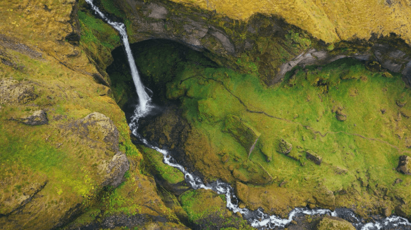
This is the trek most people mean when they talk about hiking in Iceland, a multi-day route running from Landmannalaugar’s geothermal color through fields of black obsidian and out toward Þórsmörk’s greener, sheltered valleys. River crossings are part of the deal, cold water, sometimes waist-deep, so pack and plan accordingly. For the Þórsmörk end specifically, see our dedicated Þórsmörk hiking guide.
Laugavegur and Fimmvörðuháls
4×4/F-road trailhead planning
Combine the two, and you get one of the longer treks in Iceland, stitching Laugavegur’s obsidian and geothermal color onto Fimmvörðuháls’s route between glaciers, with the pass itself weaving between Eyjafjallajökull and Mýrdalsjökull. It’s a serious multi-day undertaking, so a realistic hut, food, weather, and transport plan matters as much as fitness does. Get that groundwork right, and the terrain variety is what makes this one stand out.
Hikes That Need a Different Plan
Hornstrandir
There’s no road in here, which is exactly the point. You reach it by boat from the Westfjords, then you’re on foot in a nature reserve with no services, no roads, and no one coming to help if things go wrong. Arctic foxes roam without much fear of people, since they’ve had little reason to learn any, and the isolation is real rather than marketed. This is for experienced hikers only, with a self-sufficient plan for food, shelter, and weather worked out well before the boat drops you off.
There’s no cell service here, so it’s recommended to register your plans with SafeTravel to help authorities locate you in the case of an emergency.
Guided and specialist routes
Hvannadalshnúkur is Iceland’s highest peak and requires glacier travel and technical climbing experience. Núpsstaðaskógar is a remote multi-day route with river crossings. Neither is a casual camper van stop, so keep them as specialist options and use a qualified operator where appropriate.
Vehicle Access at a Glance
| Hike | Region | Difficulty | Vehicle access |
| Svartifoss | Skaftafell | Easy to moderate | Standard-road access |
| Dyrfjöll and Stórurð | East Iceland | Moderate | Standard-road access |
| Þakgil | South Iceland | Easy to moderate | Standard-road access |
| Reykjadalur | Near Reykjavík | Easy to moderate | Standard-road access |
| Arnarstapi | Snæfellsnes | Easy | Standard-road access |
| Glymur | Hvalfjörður | Moderate | Standard-road access |
| Fagradalsfjall | Reykjanes | Moderate | Standard-road access |
| Látrabjarg | Westfjords | Easy, exposed | Standard-road access |
| Esja/Keilir/Vífilsfell/Móskarðshnúkar | Near Reykjavík / Reykjanes | Moderate | Standard-road access |
| Kerlingarfjöll/Askja/Mt. Snæfell | Highlands | Moderate to difficult | 4×4 / F-road planning |
| Landmannalaugar routes | Highlands | Varies | 4×4 / F-road planning |
| Laugavegur and Fimmvörðuháls | Highlands | Multi-day | 4×4 / F-road trailhead planning |
| Hornstrandir | Westfjords | Remote multi-day | Boat access only |
What to Pack for Hiking in Iceland
Pack for wind, rain, and a temperature drop, even on a short hike. Your exact kit depends on the route, but the basics should be non-negotiable.
- Sturdy, broken-in hiking boots
- A rugged, waterproof backpack
- A map and offline navigation backup
- A phone with service where available
- A first-aid kit
- Waterproof jacket and pants
- A warm jacket, wool socks, gloves, and hat
- Layered base and mid layers
- Gaiters for wet ground
- A swimsuit for geothermal pools where appropriate
How to Prepare for a Hike in Iceland
- Check the forecast on vedur.is before you set off.
- Check trail and travel conditions on safetravel.is
- Use the 112 Iceland app, tell someone your route, and do not assume phone signal will be available.
- Stay on marked routes and follow responsible camping guidance.
- For glacier or technical terrain, book a qualified guide rather than treating it as a self-guided day hike.
FAQs
Do you need a 4×4 to go hiking in Iceland?
No. Many popular hikes are accessible from standard roads. You need a suitable 4×4 when your trailhead is on F-roads in the Highlands, including places such as Kerlingarfjöll, Askja, and Landmannalaugar.
What is the best season for hiking in Iceland?
June to September is the main hiking season for higher routes. That does not remove the need to check weather, trail conditions, and road status on the day.
Can you camp near Iceland’s best hikes?
Often, yes, but use designated campsites and plan ahead. Our Iceland campsites guide is a useful place to start: https://www.rent.is/blog/campsites-in-iceland/.
Is the Laugavegur Trail suitable for beginners?
It is a demanding multi-day trek. If you are new to multi-day hiking, build experience first or choose a guided option, and make a detailed transport and safety plan.
How do you get to Landmannalaugar?
Landmannalaugar is in the Highlands. Access commonly involves F-roads, so use a suitable 4×4, check current road conditions, and do not rely on last season’s information. See https://www.rent.is/blog/driving-the-highlands-in-iceland/.
Can I drive a camper van on F-roads?
Only if the vehicle is suitable and your rental terms permit it. Do not take a standard 2WD camper van onto F-roads. Check current conditions before leaving.
Find the Right Camper for Your Hiking Route
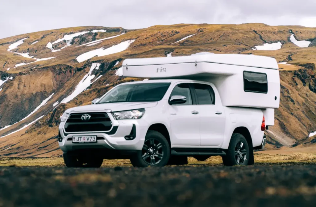
Ready for adventure on Iceland’s trails? Start with the hike, then choose the vehicle. If your plan stays on standard roads, browse our campers. If the Highlands are part of the route, look at our 4×4 campers and read the F-road guidance before booking.